Why Eastward Ho?
![]()
Why Eastward Ho?
Congestion and other urban pressures have created a westward movement of population which has over time resulted in what we know today as the suburbs. Over the past eighty years public policy and market conditions have encouraged this westward movement, often to the detriment of the older eastern urban core. Given the tremendous population growth that is projected for the next decade it is unrealistic to presume that westward movement in Southeast Florida can be completely halted or reversed. Rather, the objective of eastern urban restoration should be to capture a greater percentage of that projected growth than is now anticipated.
The cost of inefficient, sprawling development has an impact on all taxpayers, businesses, suburban and urban residents, agriculture and the natural environment. It uses up vacant land more quickly, limiting the ability to preserve environmentally sensitive lands, prime agricultural land, and water resources. Other effects of development that are not well connected to our existing urban core include:
Every public dollar spent is a decision made. Meeting the needs of expanding growth areas rather than encouraging growth in developed areas uses money that could be spent on maintaining and upgrading existing public facilities and services such as schools, parks, libraries, public landscaping, sidewalks, public transit, or public art.
In order to manage growth well, it is necessary to provide a diverse array of housing and land development options for current and future regional populations. Building housing that is well-located, safe, attractive, and convenient to public transit, schools and stores can go a long way toward improving the quality of life throughout Southeast Florida.
Western growth has an impact on lands that recharge our underground aquifers and affects the region's ability to sustain an affordable and high quality water supply. Suburban development consumes water in locations where it could be used for agriculture or for the Everglades, Florida Bay and existing wetland and upland habitats. The destruction of habitats for endangered species has an adverse effect on the quality of life in the region.
The ultimate goal of Eastward Ho! is to create sustainable communities in Southeast Florida that use resources to meet current needs while ensuring that adequate resources are available for future generations. Sustainable communities seek improved public health and a better quality of life for all residents by limiting waste, preventing pollution, maximizing conservation, promoting efficiency, and developing local resources to enhance the local economy. (Governor's Commission, 1995)
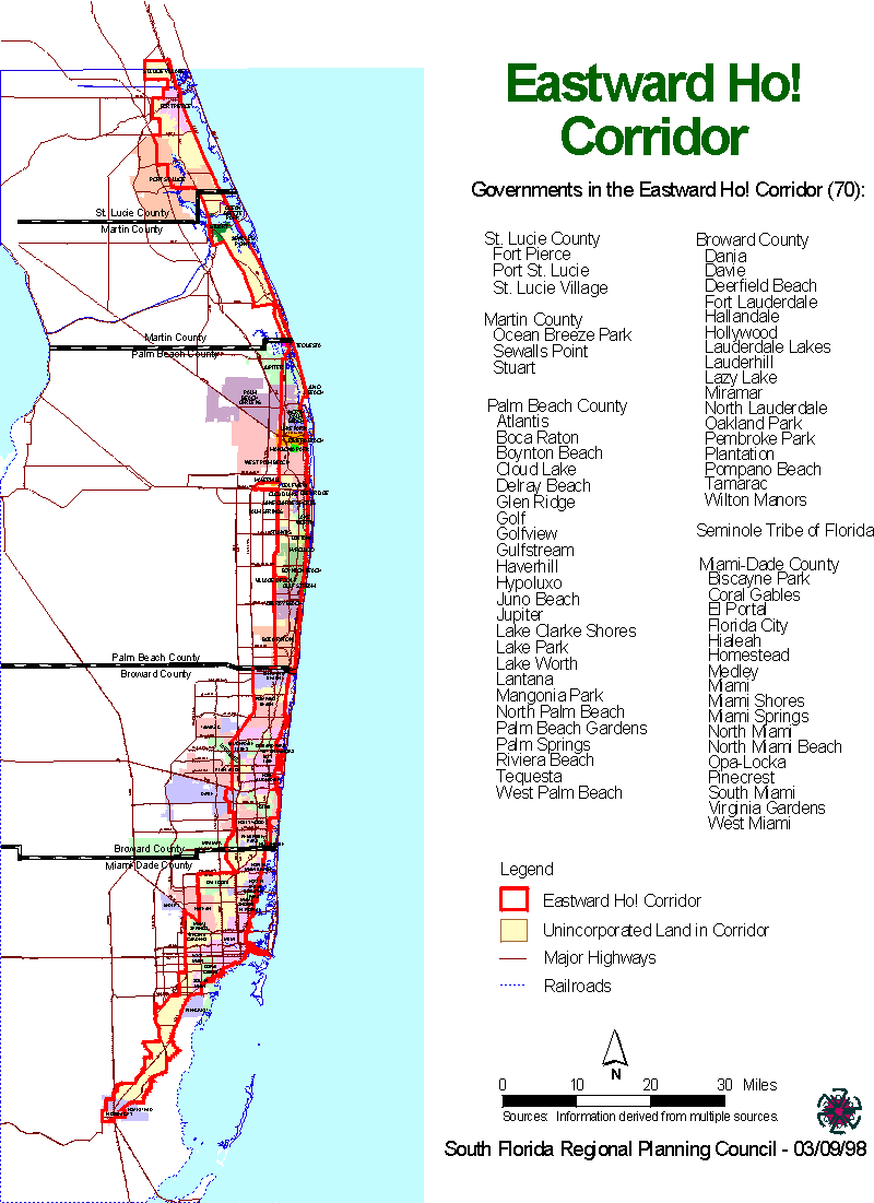
Eastward Ho! Study Area
The Eastward Ho! study area is divided into two parts -- a corridor of land between Southeast Florida's two railroads, the FEC and the CSX, beginning in southern Miami-Dade County and extending north into St. Lucie County, including major seaports, airports, and downtowns. The second part of the study area is a larger study area just outside this corridor. The Eastward Ho! study area includes the lands lying east to U.S. 1 and west to the Palmetto Expressway, the Florida Turnpike, State Road 7 and Military Trail.
In order to facilitate data collection efforts, the Eastward Ho! study area boundaries were drawn along U.S. Census Bureau boundaries. These boundaries provide statistical data related to our population and economy. Census tracts can also be subdivided into census block groups, making it possible to identify, and then include or exclude, portions of selected census tracts from the study area on the basis of demographic and socio-economic factors. Census block group analysis may be useful in local area analysis and development strategies.
[ The Council | What's New | Related Web Sites | Our Region | Current Issues ]

This page and all contents prepared by the South Florida Regional
Planning Council.
Updated on April 17, 1998