|
17th
Congressional District
|
Florida's
17th Congressional District (292KB
PDF)
Map of Florida's 17th Congressional District (Rep. Meek) which
includes parts of North Miami-Dade County and South Broward County |
|
23rd Congressional District
|
Florida's
23rd Congressional District (436KB
PDF)
Map of Florida's 23rd Congressional District (Rep. Hastings) which
includes parts of six Southeast Florida counties |
|
DRI |
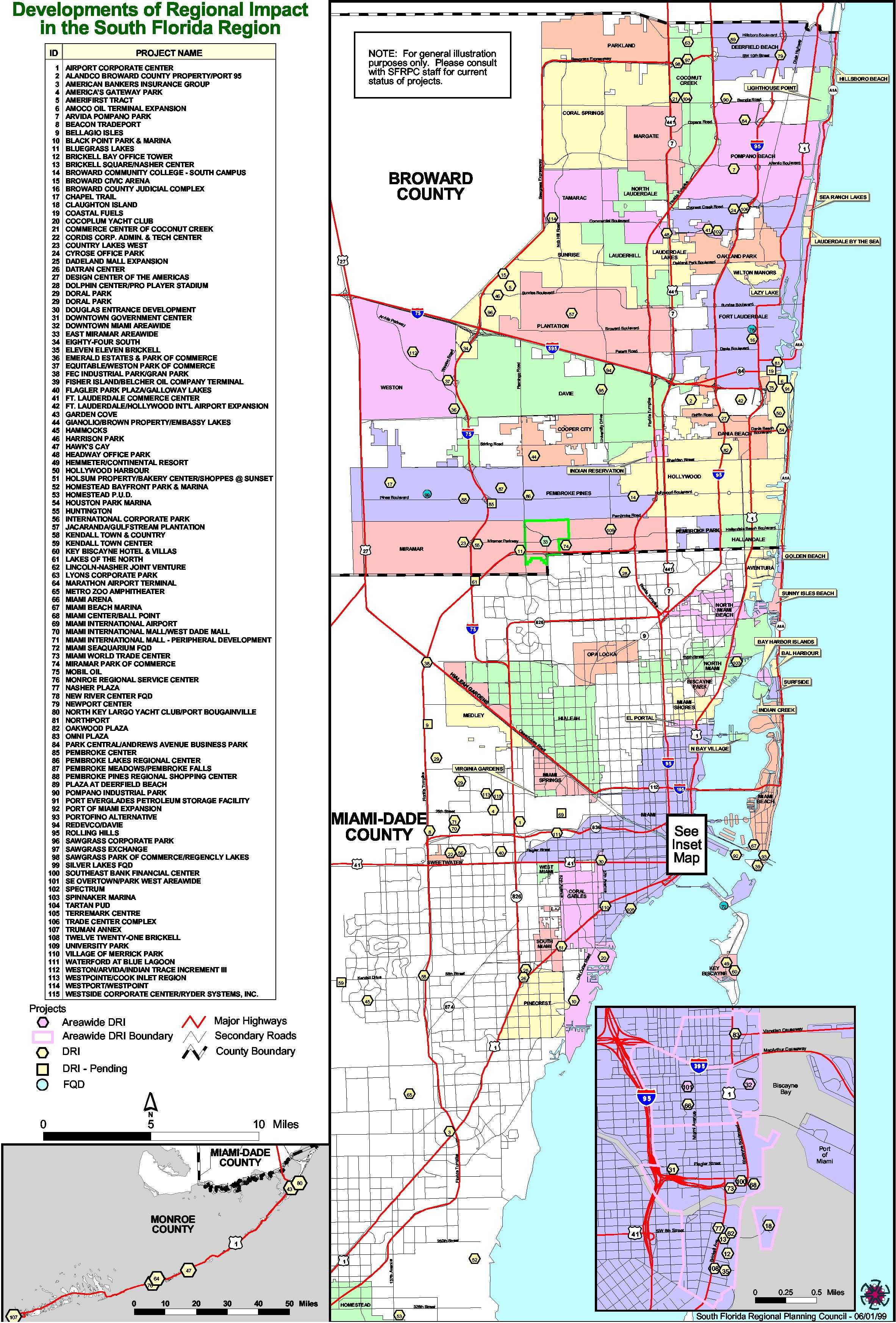
Developments
of Regional Impact (1999) (JPG)
Existing and pending DRIs and
FQDs in Broward, Miami-Dade and Monroe
counties |
Developments
of Regional Impact (2001) (4MB
PDF)
Existing and pending DRIs and FQDs in Broward,
Miami-Dade and Monroe counties |
Projects
in Miami-Dade & Broward (2004) (.8MB
PDF)
Existing, under review and proposed projects in Miami-Dade
and Broward counties |
|
Eastward
Ho! |
Eastward
Ho! Corridor Land Uses (5.3MB
PDF)
The Eastward Ho! Corridor
(extending approximately 150 miles from
northern St. Lucie County to Florida City in
southern Miami-Dade County), county
boundaries, and land uses |
Eastward
Ho! Brownfields Partnership Corridor
(PDF)
The Eastward Ho! Brownfields
Partnership Corridor (extending from the Palm
Beach/Martin County line south to Florida City
in southern Miami-Dade County), municipal
boundaries, and roadways |
| Regional
Resource Center |
Regional
Resource Center Catchment Area
(1.3MB PDF)
The South Florida Regional Resource Center,
funded by the MacArthur Foundation, is a
collaborative effort of the SFRPC, TCRPC and
the Catanese and Collins Centers. |
Southeast
Florida |
Southeast
Florida Counties (866KB PDF)
Counties in the Southeast Florida Region |
|
SR7/US441 |
Local
Governments in the SR7/US441 Corridor
(664KB PDF)
North Miami-Dade and Broward map showing cities along the
SR7/US441 Corridor |
|
SRPP
|
Livability
and Connectivity
(1.0MB PDF)
Identifying opportunities for mutually
supportive decision-making in land use and
transit |
|
Natural
Resources of Regional Significance (Map 1)
(.8MB PDF)
Water, Coastal and Marine
Resources; Planning and Resource Management
Areas |
Natural
Resources of Regional Significance (Map 2)
(.7MB PDF)
Selected Habitat Areas and
Benthic Communities |

