Monroe County Marine Management Strategic Plan
Executive Summary
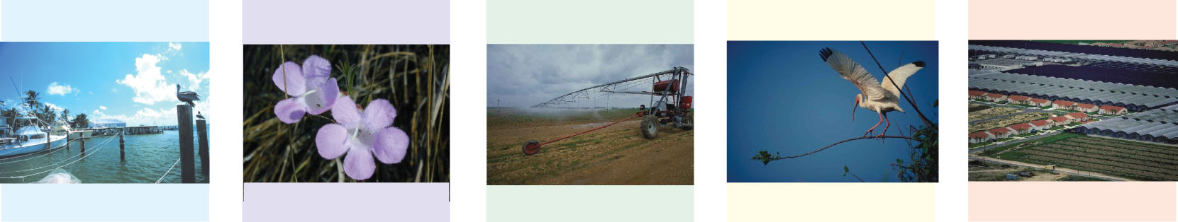
Monroe County is experiencing the loss and redevelopment of waterfront marine facilities and their associated businesses and employment. A limited supply of waterfront land and an increasing demand by different uses is leading to loss of the “working waterfront,” which includes commercial marinas, boatyards, wet and dry storage, fish houses, commercial fishing vessel dockage and marine-related industries such as boat dealers, boat repair and maintenance services, commercial fishing and tourism. The current trends are conversion of waterfront to non-water dependent uses and privatization of waterfront reducing public water access.
Monroe County retained the South Florida Regional Planning Council (SFRPC) and the Center for Urban and Environmental Solutions of Florida Atlantic University (CUES) to develop the Monroe County Marine Management Strategic Plan to provide a comprehensive strategy for protecting and preserving the working waterfronts of Monroe County. This report presents a coordinated implementation strategy specifying government policies, programs, regulations and legislative measures that will establish the structure to achieve the objective of preserving the working waterfront.
Download Documents
Please note that most files are in Adobe Acrobat PDF format. Due to their large size, it is usually best to download the files first to your computer before opening.
Right-Click the filename, choose "Save Target As" and specify a location in your computer.
Final Plan - January 17, 2006 (5.3MB PDF)
Working Waterfronts (2.1MB PDF)
Economic Analysis (165KB PDF)
Legal Overview (715KB PDF)
Martin County Ordinance (875KB PDF)
Download Map Atlas
The Map Atlas is comprised of two map sets. The overview map set includes Standard, Future Land Use and Zoning maps for the Upper, Middle and Lower Keys. The detailed map set includes Aerial Photo, Land Use and Zoning maps for the entire Florida Keys at 10-mile intervals. Please note all maps are 11x17 in size.
Map Atlas Cover (85KB PDF)
Upper Keys (1.2MB PDF)
Upper Keys FLU (315KB PDF)
Upper Keys Zoning (325KB PDF)
Middle Keys (230KB PDF)
Middle Keys FLU (230KB PDF)
Middle Keys Zoning (165KB PDF)
Lower Keys (330KB PDF)
Lower Keys FLU (415KB PDF)
Lower Keys Zoning (430KB PDF)
Database Description & Data Sources (30KB DOC)
Marine Facilities Database (115KB XLS)
Card Sound Rd to MM107 Aerials (24.5MB PDF)
Card Sound Rd to MM107 FLU (440KB PDF)
Card Sound Rd to MM107 Zoning (445KB PDF)
MM112 to MM100 Aerials (24.5MB PDF)
MM112 to MM100 FLU (550KB PDF)
MM112 to MM100 Zoning (565KB PDF)
MM100 to MM090 Aerials (20.8MB PDF)
MM100 to MM090 FLU (450KB PDF)
MM100 to MM090 Zoning (470KB PDF)
MM090 to MM080 Aerials (17.5MB PDF)
MM090 to MM080 FLU (380KB PDF)
MM090 to MM080 Zoning (360KB PDF)
MM080 to MM070 Aerials (16.2MB PDF)
MM080 to MM070 FLU (310KB PDF)
MM080 to MM070 Zoning (300KB PDF)
MM070 to MM060 Aerials (20.0MB PDF)
MM070 to MM060 FLU (290KB PDF)
MM070 to MM060 Zoning (290KB PDF)
MM060 to MM050 Aerials (17.8MB PDF)
MM060 to MM050 FLU (510KB PDF)
MM060 to MM050 Zoning (485KB PDF)
MM050 to MM040 Aerials (18.4MB PDF)
MM050 to MM040 FLU (300KB PDF)
MM050 to MM040 Zoning (290KB PDF)
MM040 to MM030 Aerials (27.5MB PDF)
MM040 to MM030 FLU (460KB PDF)
MM040 to MM030 Zoning (480KB PDF)
MM030 to MM020 Aerials (31.0MB PDF)
MM030 to MM020 FLU (790KB PDF)
MM030 to MM020 Zoning (790KB PDF)
MM020 to MM010 Aerials (27.8MB PDF)
MM020 to MM010 FLU (715KB PDF)
MM020 to MM010 Zoning (730KB PDF)
MM010 to MM000 Aerials (20.8MB PDF)
MM010 to MM000 FLU (680KB PDF)
MM010 to MM000 Zoning (650KB PDF)